3/31/2006 11:06:00 AM|W|P|Bob Hall|W|P|April Fools 04-01-06???? I have never seen a tornado in March. I’ve tried really hard and chased a lot of 50+ mph storms. I’ve seen great lowerings, persistent rotation, a reasonable clear slot, and monster hail. It seems as though the lower temp Rear Flank Downdrafts (RFD) seem to choke everything off just as the storm gets its act together. Tomorrow appears to present a Springtime WARM front/dryline event if the models and forecasters are to be believed. As my current sting of 20 busts has me a little annoyed, I’m a little jaded. Enthusiastic, but jaded. I’ll be out in western Oklahoma with Steve and Doctor Andrea Miller. Did I mention this may be a cruel 04-01-06 joke?|W|P|114382486134269938|W|P||W|P|ChaseHelp@gmail.com3/31/2006 12:48:00 AM|W|P|Bob Hall|W|P|Bust Number 3 March 30, 2006 Interesting day. I had taken the day off in anticipation of chasing. I slept in a little, and was awaken at 8:45 by my NOAA All Hazards Radio. The SPC issued a Particularly Dangerous Situation (PDS) Tornado Watch that ran until 6:00 PM CST. This is unprecedented as a watch is a medium fuse product that usually runs 2-4 hours. This was the first real planned full equipment chase day. Chase partners were Bob and Karen Hall (parents). The day did not pan out as any of the models or forecast really suggested. Storms that should cleared out were firing around 1:00 PM. I got the vehicle loaded and headed to KTUL to pickup some new gear. Swing by the parental’s at 11:00 AM and head for Ponca City, OK. We grab a McLunch in Ponca and get a little north and west of the city and get ready to watch the initial storm run over Ponca. It was not very exciting nor was it supposed to be. This was the initial round that should not be severe, it was the second round of storms that would have the dynamics to work with. I can see an impressive looking (round 1) storm near Stillwater. Joel Genung had arrived a NWS Tulsa and was getting up to speed and had not put the repeater network into weather net mode. There is some very subtle language in his update that tells me Pawnee and Osage counties are going to be of interest. I decide to check in and let him know where I am. About one minute later I get a call on the repeater network that suggests that Burbank, Fairfax, and Ralston are going to be of interest in 45 minutes. The storm that was over Ponca is Tracking NE along 60. 60 East is the road option Burbank and 11 which is the North/South option that hits all of the target cities. We decide to push through this storm with heavy rain and sustained 45 mph winds to get to our intercept (great driving Dad). We reach the intersection of 60 an 11 and have data on large hill so we hold up and I check in with WX5TUL. Joel still likes the plan so we head south to Ralston. Just as we get to the Arkansas river the storm is looking impressive and someone is reporting a lowering. There are a bunch of trees and we just can’t see. Joel cautions not to cross the Arkansas river as there are no road options. We hold Just north and are able to report a sustained lowering with persistent rotation. We chase this north and east through Fairfax and then some county roads towards Strohm. Several times the storm got its act together and about 5 NE of Fairfax, there were several lowerings that converged and the clear slot became very bright. This is about as close as you can come to a funnel and then maybe a tornado. We stand down and head back to the hill on 11 and 60. Very spotty data and no cell. I desperately try to get video back to KTUL to no avail. We still expect the real storms to fire between 4 and 6 PM. 
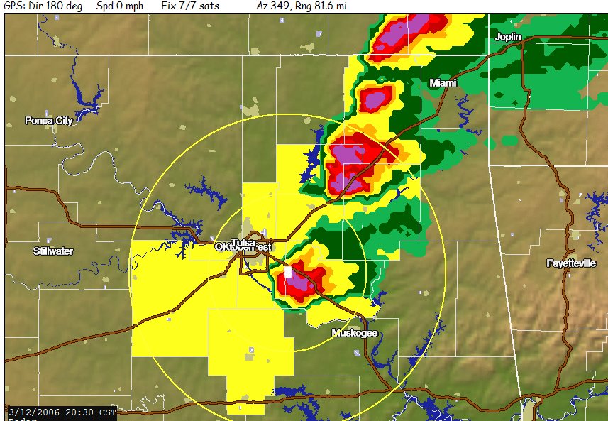
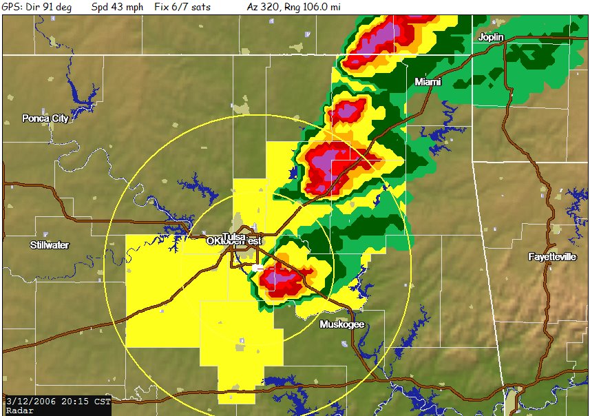
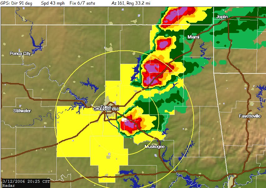
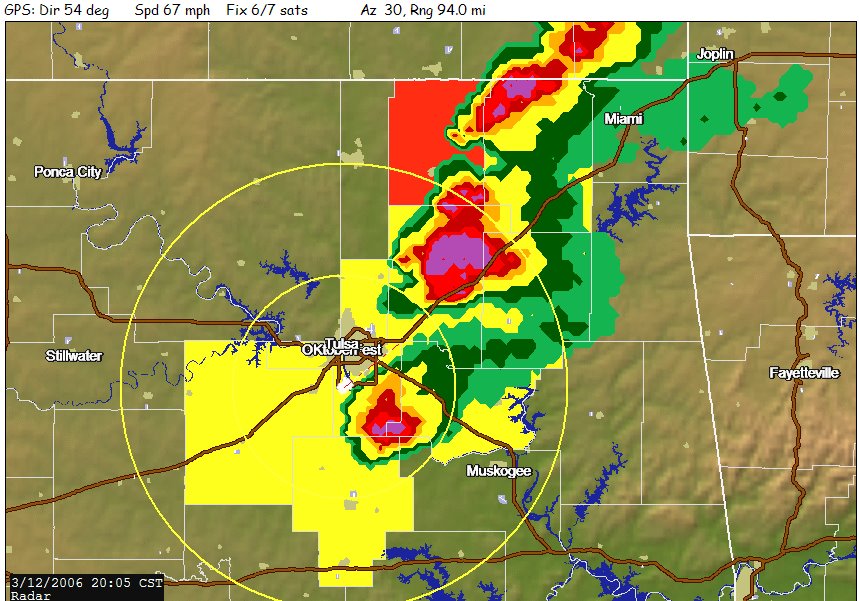
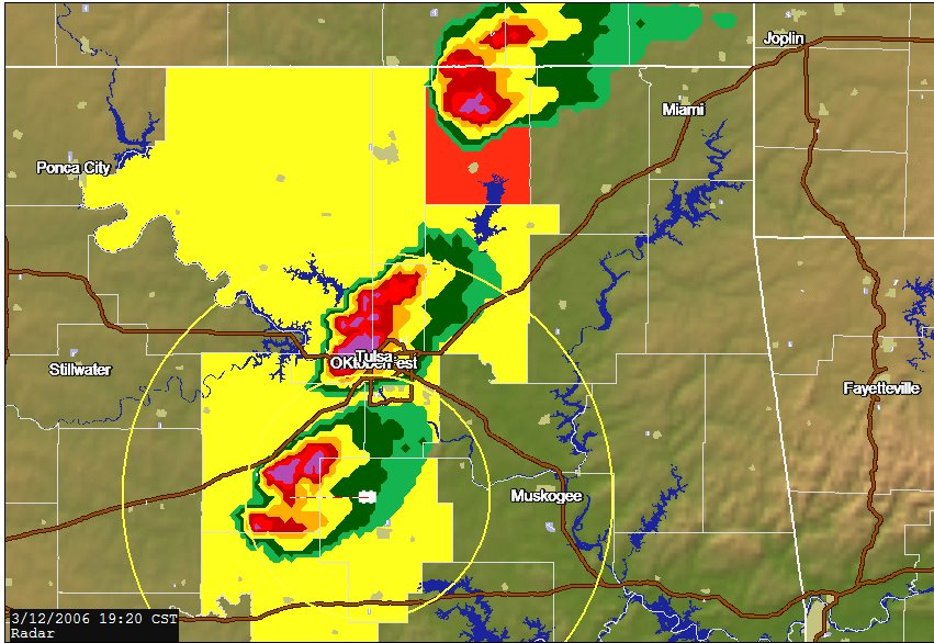
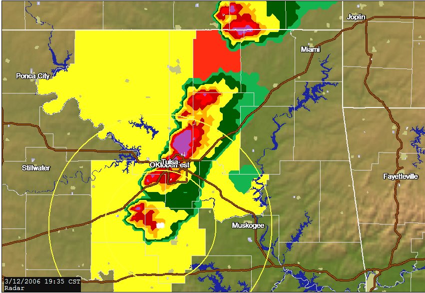
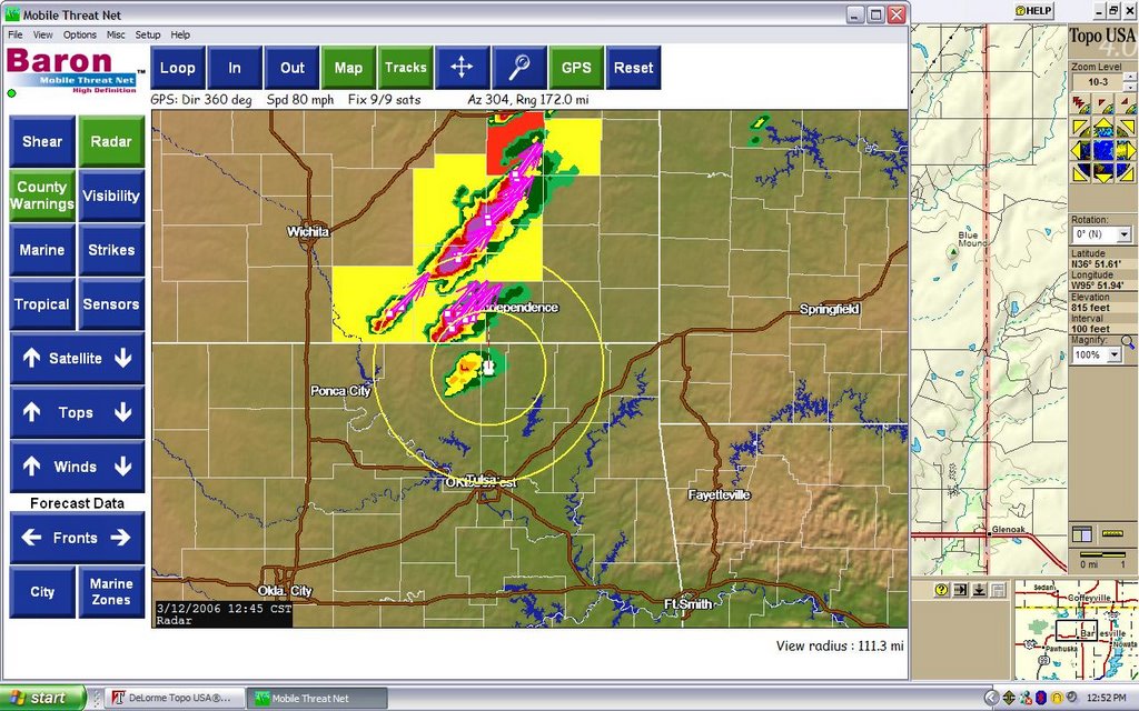
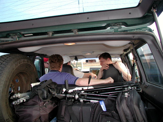
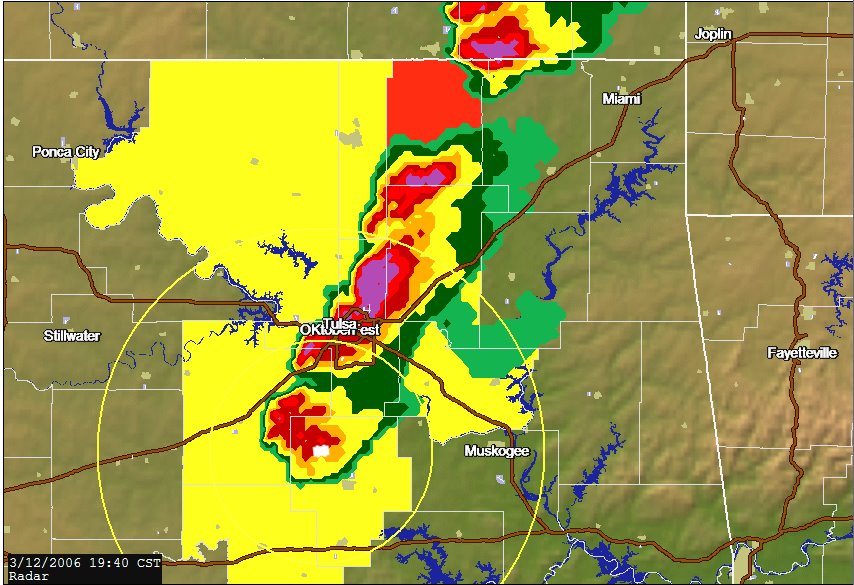
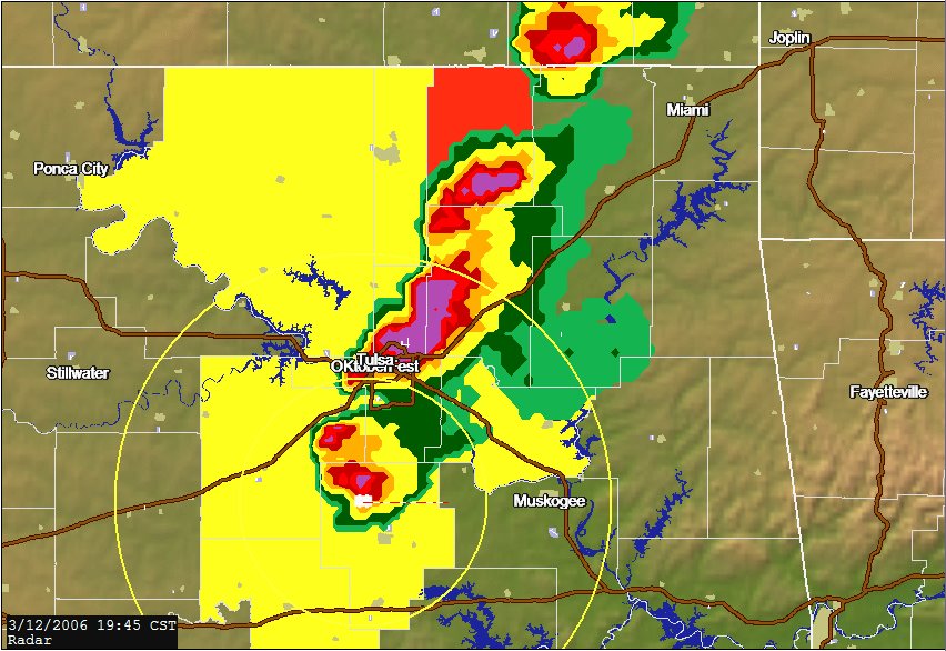
I am able to borrow a Cingular cell and call Joel on a land line. He suggests I target a bit farther south as this air has been too worked over. Joel is a really experienced chaser and I greatly respect this advice. We head to Pawnee and camp for several hours at a gas station that has a casino inside. We are in incredible air, but the cap seems to be holding. We stay on station and see some impressive cumulus with lots of anvil zit lightening and call it in. Lightening dissipates so we call it quits and head back to T-Town. 
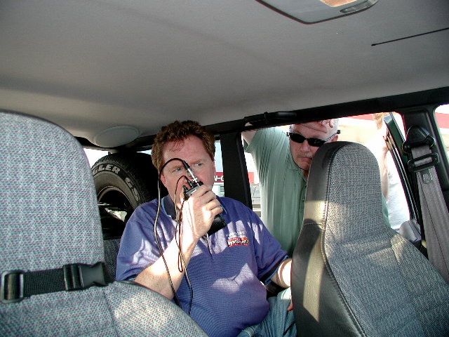
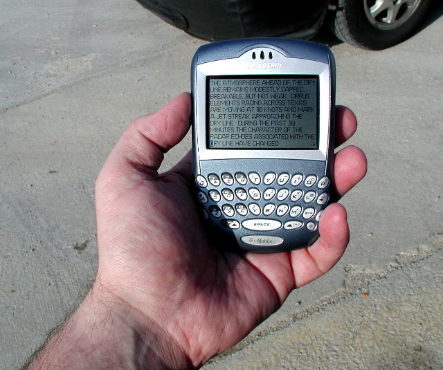
Mom cooks up some pizza rolls and Dad whips up some Sangria. The real 50 watt mobile ham radio is amazing. I was hitting every repeater all day. This is a first, as my HT was never very good in rural areas. Most of the technology stack worked flawlessly. Still working on video capture and APRS. 
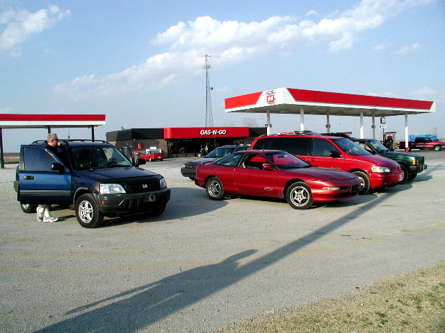
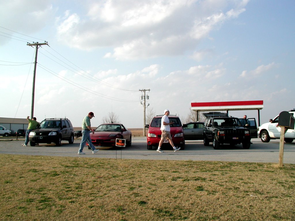
GREAT CHASE DAY!!!!!!!!|W|P|114378774885685523|W|P||W|P|ChaseHelp@gmail.com3/31/2006 07:57:00 AM|W|P|Anonymous Anonymous|W|P|Thats some kind of Casino there in Pawnee! Next time you are there you need to try a steak at Click's3/28/2006 09:24:00 PM|W|P|Bob Hall|W|P|This is the Thursday (Wednesday is currently classified as we are trying to figure out which western Oklahoma city to destroy as a test of the new Fujita scale for calibration purposes) forecast. 
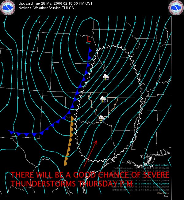
Your "shows" will be interrupted.|W|P|114360309006526478|W|P||W|P|ChaseHelp@gmail.com3/29/2006 07:43:00 AM|W|P|Anonymous Anonymous|W|P|Easy Bob.3/26/2006 11:23:00 AM|W|P|Bob Hall|W|P|Thursday 03-30-06? The models are starting to advertise a event for Thursday that I am actually starting to bite on. Roger Edwards is probably one of the finest forecasters at the SPC and he has progged this in his 4-8 day outlook which is noteworthy. Roger tends to be one of the more moderate forecasters and his stuff usually verifies. What is interesting is that everything is right down the center of the plate; 70˚ temps, 60˚ dew points, CAPE values around 2500 J/Kg, and helicity of 350 m^2/s^2. I will be chasing if trends continue. Hopefully APRS will be functioning by then and you can follow. Can you tell that I tornado deprived? 
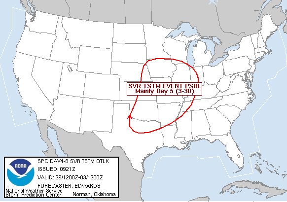
NWS Tulsa decision support page has an incredible run of spot on forecasting lately. If Thursday goes red or purple in the next few days, plan to have your "shows" interrupted. |
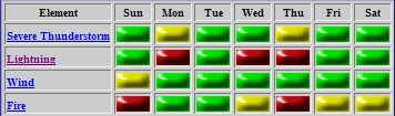
W|P|114339400299818236|W|P||W|P|ChaseHelp@gmail.com3/21/2006 12:27:00 PM|W|P|Bob Hall|W|P|What to grill tonight? Oklahoma City, OK (AP) - In light of recent rainfall, Gov. Brad Henry today lifted the burn ban for all 77 counties in the state, but he added that Oklahomans must remain vigilant guarding against the continued threat of fire. "As a result of significant rainfall over the past few days, experts at the state Department of Agriculture, Food and Forestry have evaluated the situation and believe we can now lift the statewide burn ban," the Governor said.|W|P|114296574983005701|W|P||W|P|ChaseHelp@gmail.com3/17/2006 11:21:00 PM|W|P|Bob Hall|W|P|Green County Hamfest It is Hamfest weekend in Tulsa. I actually have a capital budget that I commit to chasing each year. Since I started getting really serious about this four years ago, I have had several major milestones. 2003 Purchase Jeep Cherokee as a chase vehicle 2004 Purchase WXWorx Satellite based radar and HT 2005 Purchase High Definition Camera and upgrade DC electrical distribution system 2006 Purchase a high quality mobile Ham rig capable of 50 watts and running APRS 2007 15-20 Mega pixel SLR 2008 Satellite based Internet in the vehicle 2009 Hover conversion kit (It is 2009, where are the flying cars?) As Steve will tell you, I’m a perfectionist when it comes to technology and hardware. I can’t stand stuff that does not work and software drives me nuts (yeah that is what I do for a living). I do my research and talk to people I respect for their opinions. Ham radio has an interesting tradition of “Elmering” (mentoring) newbies into the ranks to share knowledge and best practices. Two Hams that have helped me a lot are Kelly Baker and Steve Miller Sr. After discussion with both, I ended up with a Kenwood TM-D700A, and a Larsen Coil/Whp 1.8/3.5dB NMO 2/70C, and a big ass magnet NMO mount. Lots of manual reading and learning ahead. The cool thing is that you should be able to follow my chases this season in real time as the APRS beacon function will transmit my exact position every 3 minutes. You can track me live at www.findu.com.|W|P|114265927238428271|W|P||W|P|ChaseHelp@gmail.com3/29/2006 06:21:00 AM|W|P|Blogger Steve Miller TX|W|P|A fellow IT geek! I didn't know that. What's your poison? Mine is java-j2ee/oracle/dhtml.4/02/2006 07:45:00 PM|W|P|Blogger Bob Hall|W|P|I am devepolment manager. We do the billing/remittance and call centers for CPL and WTU utilities in Texas. (Outsource Service Provide)3/13/2006 12:53:00 AM|W|P|Bob Hall|W|P| |W|P|114223328268738522|W|P||W|P|ChaseHelp@gmail.com3/12/2006 11:40:00 PM|W|P|Bob Hall|W|P|3-12-06 Chase 2 for 2006 Video and text to follow... |
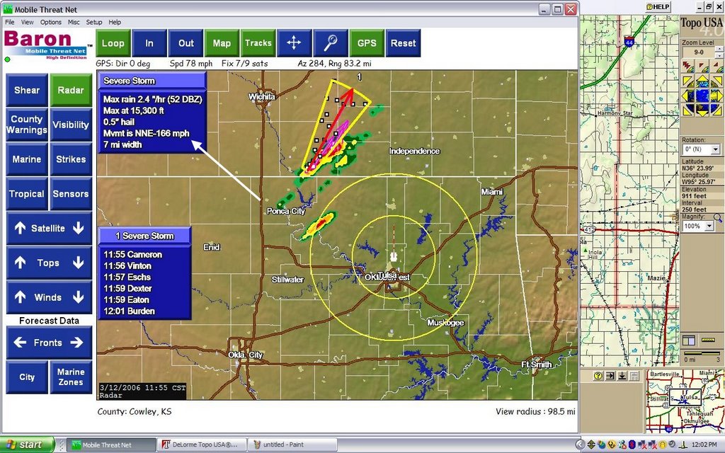
W|P|114222911308658124|W|P||W|P|ChaseHelp@gmail.com3/12/2006 01:12:00 AM|W|P|Bob Hall|W|P|We blew off TESSA and decided to chase. The two Steve Millers’ (the bad boy’s of chasing) met and chased together for the first time. As you are probably aware, the cap held and we got a sun tan. What else is there to do on a bust other than have some fun. We need a picture of the two Steves’. I quickly grab a camera and they both extemporaneously start flashing “gang” signs. I like this idea, but it is too random and there should be a secret “gang” message. It hits me that we should flash the thunderstorm symbol. http://wisesky.com/linked/avatar/smgang.gif Hans quickly figured out a reasonable approximation (sorry I wish I had a picture). This the Steves’ best attempt. Fell free to link: http://wisesky.com/linked/avatar/smweb.jpg [img]http://wisesky.com/linked/avatar/smweb.jpg[/img] Here is the avatar: http://wisesky.com/linked/avatar/smavatar.gif [img]http://wisesky.com/linked/avatar/smavatar.gif[/img]|W|P|114214758832346047|W|P||W|P|ChaseHelp@gmail.com3/11/2006 10:14:00 PM|W|P|Bob Hall|W|P|

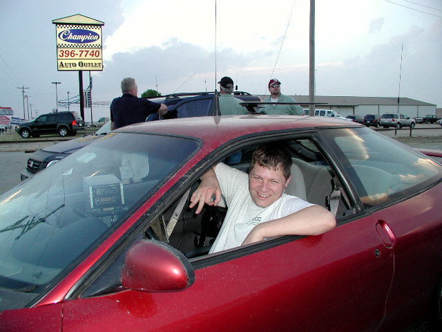
Rolling into Tulsa after bust #1 of the 2006 season. Chase partners included Steve Miller (OK), Hans Shroeder, and Steve Miller (TX). Chased around the Red River Valley. Target area was Madil, OK. More details to follow. Tomorrow looks like another opportunity.

|W|P|114213685637935123|W|P|BUST # 1|W|P|ChaseHelp@gmail.com3/08/2006 03:26:00 AM|W|P|Bob Hall|W|P|So much for chase day: |
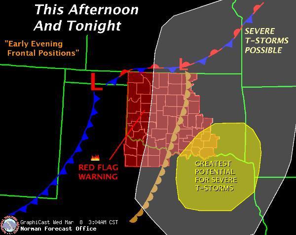
W|P|114181010150440632|W|P||W|P|ChaseHelp@gmail.com3/07/2006 07:04:00 PM|W|P|Bob Hall|W|P|March Madness The madness begins. Wednesday 03-08-06 looks like the first severe weather day for 2006 that is chaseable. Gained a little more confidence today as I refused to believe the CAPE and CINH that the models were spitting out. The cap held today. Tomorrow looks more like a May storm than the usual grungefest that March chasing usually entails. I will probably be up until midnight looking at models and awaiting the SPC Day 1 Outlook. |
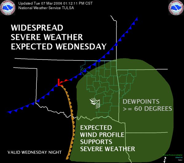
W|P|114178005286792520|W|P||W|P|ChaseHelp@gmail.com3/04/2006 10:13:00 AM|W|P|Bob Hall|W|P|From this morning's forecast discussion VERY ACTIVE WEATHER PATTERN TO CONTINUE INTO WEDNESDAY AS DRY LINE PUSHES INTO EASTERN OKLAHOMA DURING THE AFTERNOON. MAIN DYNAMICS WITH UPPER SYSTEM MAY REMAIN WEST OF THE AREA DURING THE DAY LIMITING CONVERGENCE/THUNDERSTORM DEVELOPMENT ALONG DRY LINE. HOWEVER AS STRONG 50H SHORT WAVE MOVES INTO WESTERN TEXAS WEDNESDAY NIGHT...STRONG TO SEVERE THUNDERSTORMS ARE EXPECTED TO DEVELOP...SPREADING ACROSS ENTIRE AREA ON THURSDAY. ALTHOUGH THE EXACT TIMING OF SYSTEM IS STILL IN QUESTION...WILL LIKELY SEE A SIGNIFICANT ROUND OR TWO OF SEVERE WEATHER WEDNESDAY AND/OR THURSDAY. |W|P|114148902876746048|W|P||W|P|ChaseHelp@gmail.com3/02/2006 11:42:00 PM|W|P|Bob Hall|W|P|This is pretty much my life |W|P|114136461425227474|W|P||W|P|ChaseHelp@gmail.com3/04/2006 01:21:00 PM|W|P|Blogger Steve Miller|W|P|Bob, that is officially - your life.
Congrats man!!!